
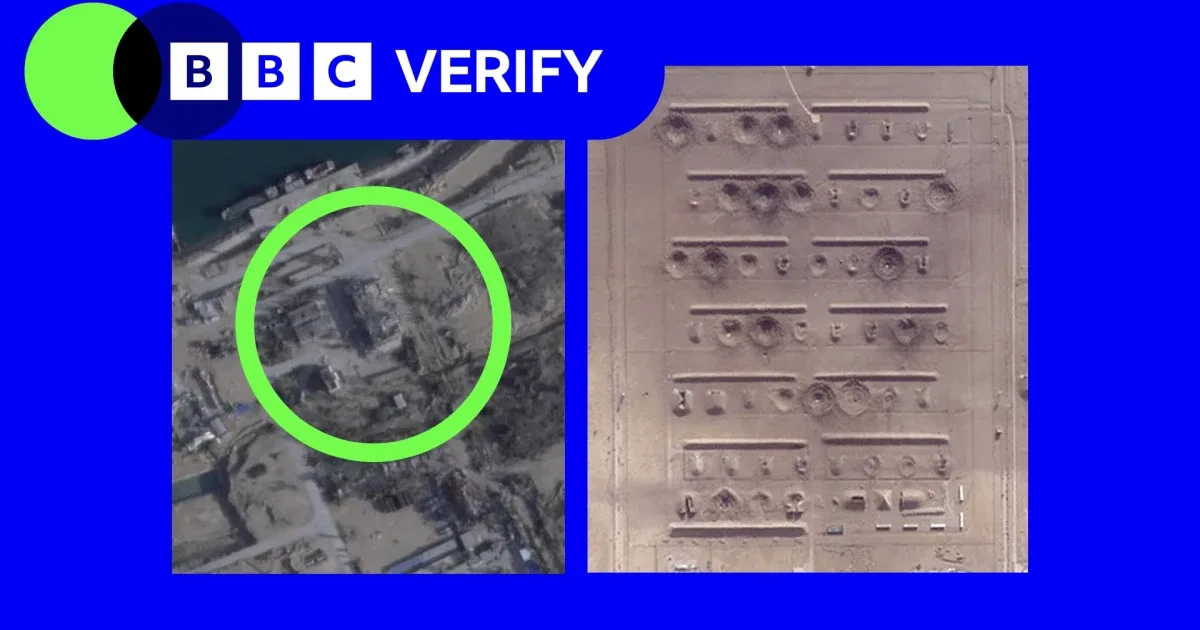
Recent satellite imagery has revealed extensive damage to Iran’s missile, nuclear, and military infrastructure at key locations including Esfahan and Bushehr. These images, captured after commercial satellite access was limited, show that storage areas for ammunition, ballistic missile facilities, and surface-to-air missile sites have sustained significant impacts.
This damage was identified through analysis by BBC Verify and military intelligence firm Janes, confirming hits on a range of strategic sites. The imagery brings into focus the widening scope of the conflict, which erupted after U.S. and Israeli strikes on Iran in late February 2026, prompting Iranian retaliatory attacks against Israel and U.S. bases in Gulf countries.

Commercial access to satellite images over Iran tightened sharply starting in March, with Planet Labs suspending all imagery releases of Iran and the surrounding conflict zones at the U.S. government’s request. This restriction, extended indefinitely in early April, limits the flow of real-time data to journalists and analysts who depend on satellite visuals to verify damage and corroborate field reports.
Such imagery remains critical since on-the-ground verification is often impossible in conflict zones. Analysts note that while satellite photos can confirm visible surface damage to buildings and storage facilities, they cannot determine the operability of underground systems, remaining weapon capabilities, or who exactly carried out the strikes. This means that while the destruction is clear, the full military impact on Iran’s nuclear and missile programs remains uncertain without further intelligence.
The initial phase of the conflict already showed damage beyond nuclear sites, affecting naval bases, airports, and other military installations inside Iran. With commercial data now restricted, each satellite image released assumes heightened importance for policymakers and international observers assessing Iran’s strategic posture and capabilities.